It is possible to get around Málaga in 35 stages and 650km. Walk along the Costa del Sol from side to side. Reach the northernmost tip and find your way back to the Mediterranean. This is what the Málaga GR footpath offers –a pioneering route to get around the province along signposted hiking and cycling trails leading to the most beautiful natural areas and villages.
In its coastal stretch, the Málaga GR footpath runs parallel to the Mediterranean. It is 180km along the Costa del Sol, from Manilva in the west to Nerja in the east. This is where the footpath’s starting point (Km. 0) is. To your left, the final stages. To your right, the road to hit.
The trip moves counterclockwise leading to Rincón de la Victoria, the goal of stage 1. You will spot the watchtowers that Málaga’s beaches are peppered with. The Balcony of Europe in Nerja (stage 4) marks the end of the coastal itinerary. Off into the hinterland now.
East
Sierras de Tejeda, Almijara y Alhama Nature Park is the big star in the early stages of the eastern part of the Málaga GR footpath. In stage 5, from Nerja to Frigiliana, you will come to the region of Axarquía. Climbing up mountain trails and across rivers you will reach the highest point: La Maroma, over 2000m above sea level. The area is characterised by sharp slopes and vertigo-inducing ravines. Due to soil composition and proximity to the sea, the vegetation is abundant and variegated.
The eastern stretch leads to the northernmost tip of Málaga Province, in the village of Cuevas Bajas, close to the border between Córdoba and Seville. This part of the route, in the heart of Andalusia, will give you the chance to take a look at traditional cortijos (farmhouses) and reservoirs.
West
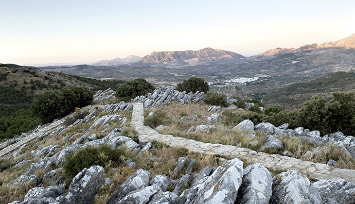
Past the northernmost tip of Málaga, the route leads back to the Mediterranean along the western side of the province, amidst scenic views. In Sierra de Yeguas you will come to Laguna de Fuente Piedra Nature Reserve. Down south, you will cut across Serranía de Ronda (watch out for snow-capped peaks in winter!), perpendicular to Sierra de Grazalema. The river Guadiaro, a mighty presence in the area, is home to a large community of herons in the summer. The most common trees are elms, African tamarisk and poplars.
The final stretch on the west side goes from Casares to Manilva. Here you will spot the blue shades of the Mediterranean again. Stages 30 to 35 will bring you back to Km. 0.
The Málaga GR footpath can be divided into three stretches: coastline, east and west.Coastline12 May 2016


